Actionable Long-Term Adaptation Planning
Lying low along the San Francisco Bay, the neighboring shorelines of Alameda and Oakland are already susceptible to the hazards of climate change: coastal flooding, rising ground water, inland flooding, along with a high risk of liquefaction. Recognizing that flooding and climate change do not respect jurisdictional boundaries, the Oakland Alameda Adaptation Committee (“OAAC”) formed as a coalition between these cities – with regional, state, and federal agencies, and scientists, engineers and local community-based organizations – to plan and adapt to coastal and inland flooding, improve habitat, and promote equitable community resilience within the subregion.


The Subregional Adaptation Plan is a framework that details preliminary strategies and pathways for shoreline communities to take as the climate and shorelines change over time, in accordance with California state law SB 272 and BCDC’s Regional Shoreline Adaptation Plan (RSAP) guidelines.
The Oakland-Alameda Estuary Project is a near-term sea level rise adaptation design project that elevates low-lying areas of the shoreline, layered with improvements to intertidal and upland habitat, and green and grey detention to address coastal, stormwater, and groundwater flooding for up to two feet of sea level rise over the coming decades around the Posey and Webster tubes that connect Alameda and Oakland.
The Bay Farm Island Adaptation Project addresses near-term coastal and inland flood risk, ongoing shoreline erosion, and necessary improvements to stormwater system capacity. The shallow and wide shoreline allows for expansion of intertidal habitat, tidal marshes, and providing generous public access to this unique stretch of the bay shoreline.


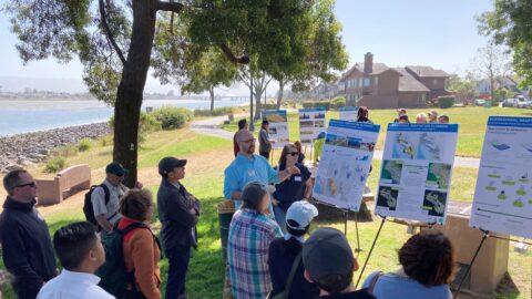
CMG’s approach is grounded in the Framework for Community-Driven Climate Resilience Planning developed by the National Association of Climate Resilience Planners, which details the essential components of successful engagement. As the community embarks on a complex, multi-generational dialogue to plan for sea level rise, it is imperative to enter the conversation with humility and respect; building on the indigenous concept of reciprocity to envision and realize a waterfront that is resilient, equitable, accessible, and regenerative.

The adaptation of the waterfront includes numerous challenges and opportunities to preserve and improve the shoreline as a place to move, gather, recreate, and learn from the temporality of these changing landscapes. On the northern shoreline of Bay Farm Island, the daily fluctuations of the bay are viewed from overlooks and get-downs built as part of the adaptation of the Bay Trail and a pump station outfall structure. By optimizing co-benefits that improve habitat and public access, we can help ensure financial feasibility and enduring community support.