


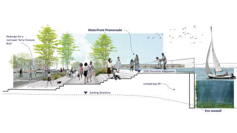
An Urgent Call to Action + Open Space Opportunity
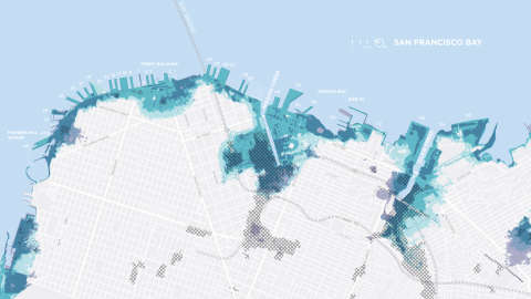
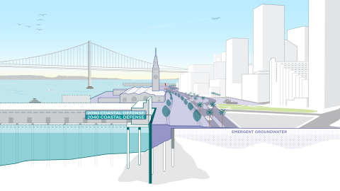
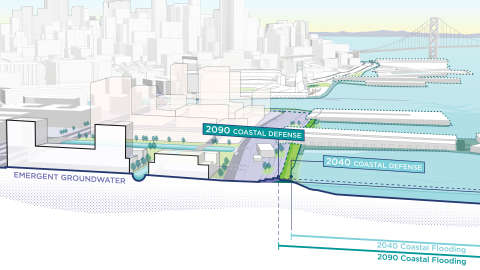
To defend San Francisco from current and future flood risks, there is a need to adapt the shoreline to address up to seven feet of sea level rise projected by 2100. Any effort aimed at long-term sea level rise resilience should also strengthen the waterfront against the urgent earthquake risk we face today. The scale of change necessary provides a once in a generation opportunity to not only defend our city from flood and earthquake risks, but also to rejuvenate the waterfront, improve the City’s connection to the Bay, and bring co-benefits such as improved public open space, increased waterfront access, enhanced mobility, while also increasing safety, ecological health, and job opportunities.
Working alongside diverse and collaborative teams of engineers, urban designers, planners, and public engagement specialists, CMG brings a holistic, landscape-driven approach to the process of adaptation planning and risk mitigation. CMG’s efforts in support of the adaptation strategy development process are multi-faceted – ranging from process design, public engagement, and narrative development to technical analysis and ecological planning.


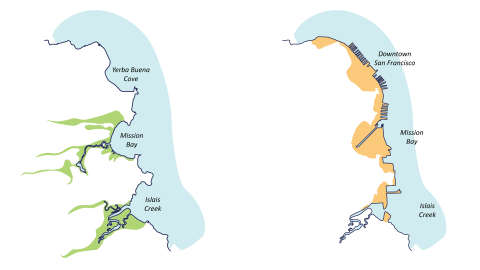
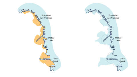
This program represents different approaches to addressing the same risks and to identify a cost-effective approach to risk reduction while also achieving public realm and community benefits. The intent is not to choose one – rather, it is to select the ideas that best serve our city and communities and hybridize those ideas into a unified Waterfront Adaptation Plan that will guide our city into the next century.
What happens along the San Francisco Waterfront impacts San Franciscans in every corner of the city. The scale of change necessary provides a once in a generation opportunity to not only defend our waterfront, but also to achieve of the Waterfront Resilience Program’s broader goals related to equity, ecology, and access, and community benefit.
The preliminary preferred Waterfront Adaptation Plan is anticipated to undergo environmental review (NEPA/CEQA review) through 2025 – at which point a Final Waterfront Adaptation Plan will be created and presented to the U.S. Congress for potential federal funding of up to 65% of the project cost.